Geographic Information Systems (GIS) and earth observation
“You can’t use an old map to explore a new world” – Albert Einstein
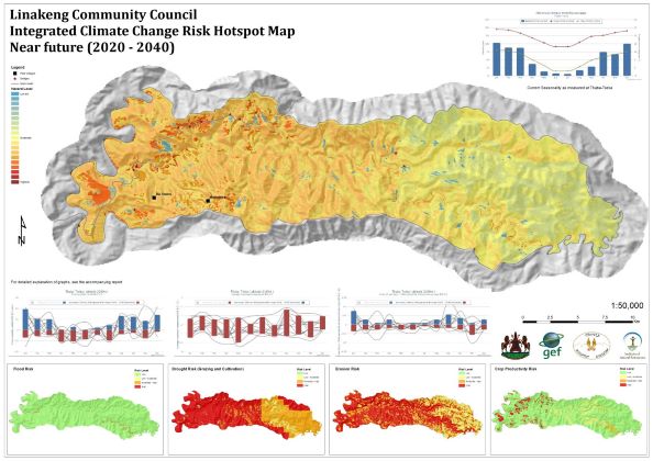
Geographic Information Systems (GIS) are a fundamental and rapidly advancing tool in understanding and describing spatial relationships that exist in our environment. Almost every environmental assessment, plan, intervention or project includes the need to answer the question of ‘where…?’. GeoNest is fundamentally aligned with this question and GIS and spatial analysis forms an integral part of almost every GeoNest project.
Remote Sensing and Earth Observation are closely related to GIS. Satellite and UAV acquired imagery are increasingly becoming the primary source of large-scale data from which information about our environment is generated. Catchment scale assessments and long-term monitoring of changing landscapes, amongst a wide range of other applications, are made possible using freely available moderate to high resolution satellite imagery such as from the Copernicus Hub (https://scihub.copernicus.eu/). Analysis of ‘Big Data’ from these sources is increasingly possible through cloud based analytics platforms such as Google Earth Engine. Finer scale assessments of variables such as water quality assessments of small rivers are possible using similar remote sensing technology, but using much higher resolution imagery sourced from UAV platforms.
Environmental information systems are software applications that provide the interpretive bridge between data and information. They allow the publishing and sharing of information about the environment and from a GeoNest perspective, particularly the spatial relationships that exist between variables in the environment.
GeoNest Spatial offers the following expertise:
- Spatial data capture, editing, analysis and storage, mapping and modelling.
- Remote sensing and earth observation data analysis in support of large-scale environmental studies.
- Development of online spatially enabled environmental information systems.
- Capacity development and training in GIS and earth observation
Key projects include
- Climate suitability mapping for mango production
- Carbon credit projects
- Technical Assistance for the Programme for Transboundary Water Management in the Cubango-Okavango River Basin OKACOM – Angola, Botswana, Namibia.
- Water quality assessment using UAV mounted multispectral sensor.
- Development of an Invasive Alien Plant mapping protocol.
- Visibility assessments and visual impact assessments
GeoNest (Pty) Ltd. is proudly carbon neutral in 2023 and supports a just transition to a green global economy
#ClimateChangeIsReal


